Log in
All resources
Create a design
312 Free Artworks of Road Map
fonds ancely - bibliothèque municipale de toulouse - maps
steel engraving print
bibliothèques de toulouse
raymond bonheur
victor levasseur - maps of france
bibliothèque nationale de france
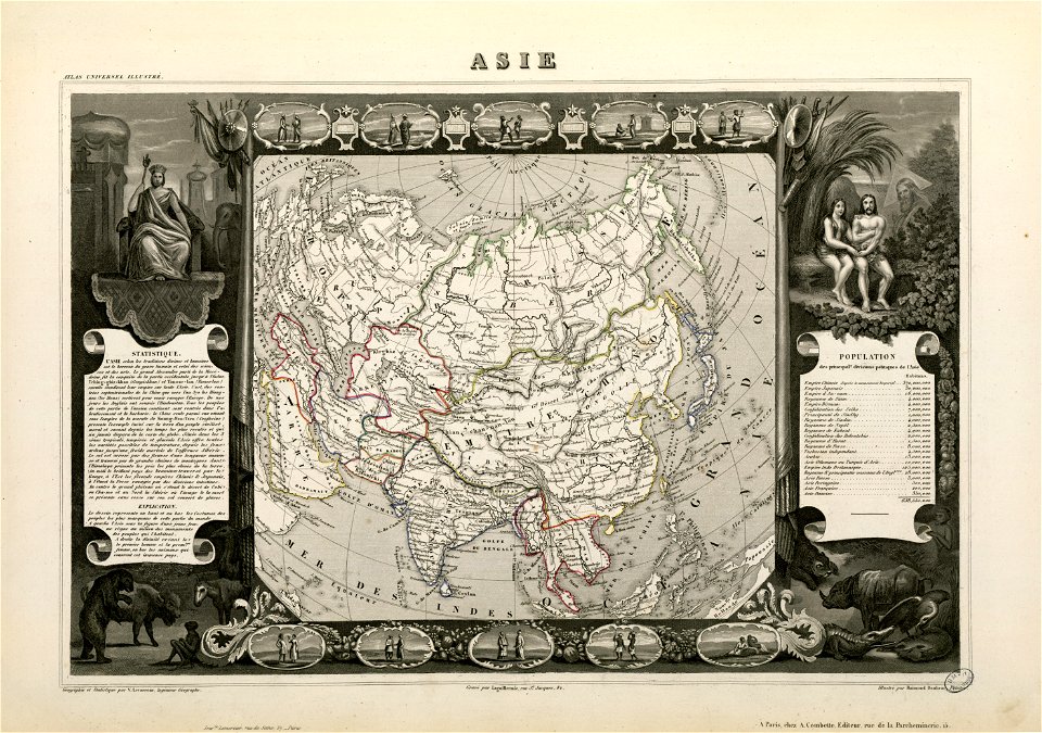
victor levasseur - maps of the world
maps by thomas kitchin
thomas kitchin
maps in the library of congress
maps of kraków
planty
war of jenkins' ear
edward vernon
victor levasseur - maps of the world
coats of arms of switzerland
chicago and the midwest, newberry library
surveying in united states
road maps of arizona
catalina highway
chicago and the midwest, newberry library
rand mcnally
chicago and the midwest, newberry library
rand mcnally
20th-century maps of illinois
curt teich postcard archives
old county maps of hertfordshire
maps by thomas kitchin
maps in the library of congress
1852 maps
gemeente atlas van nederland - limburg
maps of tegelen
victor levasseur - maps of the world
1850s maps of oceania
maps by alexis-hubert jaillot
1730s maps of france
cornell: persuasive cartography: the pj mode collection
kellanova
maps from the mechanical curator collection available to georeference
maps from the mechanical curator collection
coats of arms of mézières (ardennes)
victor levasseur - maps of france
maps in the library of congress
1861 maps of the united states
victor levasseur - maps of the world
old maps of north america
bird's eye view of knoxville, tennessee, 1886
maps in the library of congress
maps in the library of congress
emory place historic district
victor levasseur - maps of france
19th-century maps of finistère
old maps of schweinfurt
baroque
danubius pannonico-mysicus
1726 maps
roads in alpes-de-haute-provence
nature of allos
victor levasseur - maps of the world
neoclassicism
library of congress artist posters collection
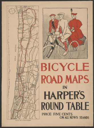
harper's magazine posters, 1895
coats of arms of cities in nièvre
andré dupin
19th-century maps of gloucestershire
old maps of cheltenham
plan routier de la ville et faubourg de paris by jean lattré
maps of paris from bibliothèque nationale de france
plan routier de la ville et faubourg de paris by jean lattré
maps of paris from bibliothèque nationale de france
plan routier de la ville et faubourg de paris by jean lattré
maps of paris from bibliothèque nationale de france
19th-century maps of charente
1842 maps
topographia franconiae (merian)
baroque
lithographs in the rijksmuseum amsterdam
conrad leemans
victor levasseur - maps of the world
french algeria
maps by jan eduard wagner
františek kytka
19th-century maps of bohemia
1880s maps of czechia
smedslätten
ålsten
coats of arms of rhône
old maps of rhône
19th-century maps of france
1854 maps of france
maps from the earth and its inhabitants, vol. xi
algeria in the 1800s
maps in the british museum
old maps of dunkerque
19th-century double hemisphere world maps
maps by alexandre vuillemin
maps from the mechanical curator collection available to georeference
maps from the mechanical curator collection
picturesque tour from geneva to milan, by way of the simplon (1820)
maps from the mechanical curator collection
pierre antoine tardieu
heinrich keller
victor levasseur - maps of the world
1854 maps of africa
plan routier de la ville et faubourg de paris by jean lattré
maps of paris from bibliothèque nationale de france
coats of arms of cities in haute-marne
charles-guillaume étienne
maps in the british museum
maps of kensington gardens
a new & correct map of england and wales (foster)
1750s maps of england
coats of arms of cities in var
19th-century maps of var
victor levasseur - maps of france
coats of arms of perpignan
maps by wilhelm maximilian carpelan
zetterbergsvägen
danubius pannonico-mysicus
1720s maps of hungary
maps in the british museum
james basire
maps in the british museum
james basire
19th-century maps of seine-et-marne
coats of arms of seine-et-marne
georges-louis leclerc, comte de buffon
coats of arms of dijon
coats of arms of auch
old maps of gers
old county maps of oxfordshire
bodleian maps collection
victor levasseur - maps of france
engravings by nicolas mignard
coats of arms of cities in drôme
jean étienne championnet
coats of arms of orléans
gaspard de coligny
coats of arms of cities in ardèche
victor levasseur - maps of france
victor levasseur - maps of france
old maps of gironde
19th-century maps of loire-atlantique
pierre cambronne
pierre terrail de bayard
casimir pierre perier
19th-century maps of loire (department)
coats of arms of cities in loire
coats of arms of cities in lot-et-garonne
victor levasseur - maps of france
old maps of northumberland
maps by thomas kitchin
maps of spain by tomas lopez
1761 maps of spain
maps in the library of congress
new york illustrated news
victor levasseur - maps of the world
historical images of arecaceae
curt teich postcard archives
map postcards
cornell: persuasive cartography: the pj mode collection
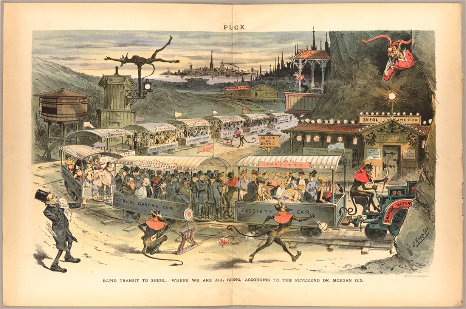
cartoons by joseph keppler
coats of arms of chalon-sur-saône
alphonse de lamartine
coats of arms of nîmes
baroque
19th century maps of haute-vienne
coats of arms of haute-vienne
victor levasseur - maps of france
pierre-jean david
coats of arms of saint-brieuc
old maps of côtes-d'armor
victor levasseur - maps of the world
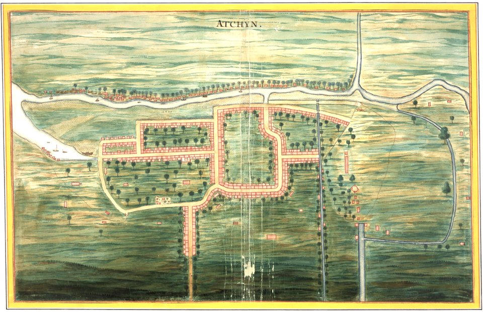
old maps of asia
curt teich postcard archives, curt teich & company
map postcards
maps by john cary
1799 maps
maps of the dutch east india company - indonesia
watercolor drawings by johannes vingboons
coats of arms of cities in manche
19th-century maps of manche
victor levasseur - maps of france
19th-century maps of ain
old maps of charente-maritime
coats of arms of la rochelle
coats of arms of cities in pyrénées-atlantiques
old maps of pyrénées-atlantiques
bibliothèque nationale de france
maps by thomas kitchin
18th-century maps of cornwall
maps by thomas kitchin
maps by thomas kitchin
old maps of hampshire
old maps of oxfordshire
maps by thomas kitchin
victor levasseur - maps of the world
19th-century maps of martinique
maps in the british museum
james basire
1834 in galicia (spain)
galiciana
18th-century maps of the mediterranean sea
1745 maps
18th-century maps of england and wales
chorographia britanniae (1741-1742)
old maps of lycoming county, pennsylvania
maps in the library of congress
18th-century maps of england and wales
chorographia britanniae (1741-1742)
101 - 200 of 312
Next page
/ 4


![[Oxfordshire by Thomas Kitchen], Thomas Kitchin, 1750](https://cdn.creazilla.com/illustrations/10001146500/oxfordshire-by-thomas-kitchen-thomas-kitchin-1750-sm.jpg)